Chemin de Saint Jacques de Compostelle
Website : Click here !
Around 800, in Galicia, a hermit named Pelayo had a revelation in his sleep. Guided by a star (campus stellae, hence Compostela), he discovered a tomb, which was attributed by the Church to Saint James, the first Christian martyr and brother of Saint John the Evangelist. The pilgrimage was born. It wasn't until 1492 that it was recognised by the papacy as one of the three pilgrimages of Christianity. Today, more than 200,000 pilgrims, armed with their credencial (pilgrims' passport), set off every year on foot, by bike or on donkeyback along the roads to Compostela.
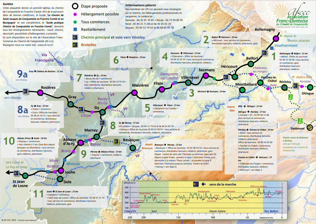
The Chemin de Compostelle in Franche-Comté is the missing link between the Alsace route and the Cluny route to Le Puy-en-Velay. It is signposted with a European shell on a blue background, itself on a white background.
The slip road from Gy to the Vézelay route is signposted with the European shell on a blue background, itself on a yellow background.
The route sometimes takes you along roads, so take care (walk on the left), particularly on the departmental roads between Gray and Nantilly.
Along the way, you will be warmly welcomed by a wide variety of establishments, particularly private homes. To make it easier for you to get to know the hosts, here are a few tips:
- book 48 hours in advance
- you must show your credencial
For more information, visit the website of the Association Franc-Comtoise des Chemins de Compostelle www.af-ccc.fr
Types of route :
Foot
Duration of the route :
30h
Distance of the route (in Km) :
150
Departure municipality :
HERICOURT